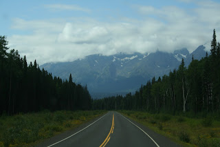
After driving a typical Canadian two-lane black top road with lots of trees and pot-holes from Whitehorse, Yukon to Watson Lake, Yukon, we finally started heading SOUTH onto the Cassiar Highway to Dease Lake.
First you have to understand the Cassiar Highway - 476 miles of narrow semi-paved roads, limited services, always under repair, no centerline or side markings or shoulders and one lane wooden bridges. We were without phone service for days and felt lucky to find a campground with some semblance of WIFI. The villages have electricity provided only by generators. But the scenery along this highway is well worth the lack of services.
Many small lakes, rivers and ponds along the highway. This particular stretch at Blue Lake shows a 2010 burn. Lightning burned more than 74,000 acres.
Narrow roads with shoulders that would drop off up to 10 feet.
If you were very lucky, you didn't meet one of these at a bridge or curve, but you did slow down to almost stopping to let them barrel down the road.
Surprise, A stretch of highway with lines and dividers.
Simmons Lake lunch stop along the highway.
Lunch was great and so was the view.
A little maintenance to straighten the tow hitch - too many bumps and rough roads.
A stop at Jade City (tourist trap). The Cassiar Mountains supplies 92% of the world's jade. But they sure like their product. Prices were about 4 times higher than the norm in the "lower 48".
A special site - momma bear and her 2 cubs crossing the highway. We had to stop so they could cross safely.
This metal bridge was about 1 1/2 car widths. Glad there were no trucks coming our way.
More Cassiar Mountain views and rough roads.


No comments:
Post a Comment